


In early August, Greenpeace China’s forest campaigner Wu Hao wrote a piece in the environmental section of the newspaper Southern Weekly about China’s astonishing rate of deforestation. He posted dramatic before and after satellite images of forests cleared in Zhejiang province, in southeastern China. Wu talked to Michael Zhao about deforestation and the power of images in environmental campaigns.
What drove the clear-cutting of forests in Zhejiang? Urbanization? Real Estate? Timber?
Primarily, it’s the massive expansion of cities in Zhejiang that has driven the recent deforestation epidemic. As cities swallow up surrounding farmland, forests in remote areas are cleared to create more farmland to compensate for the loss. This is done in order to comply with China’s “requisition-compensation balance” policy for farmland, which requires that an acre of new farmland be created for every acre of old farmland converted to non-agricultural uses. Taking advantage of a loophole in current regulations, people are cutting down natural forests under the policy of “low-yield forest improvement” in order to maintain the requisition-compensation balance, which runs counter to the overall national policy of protecting forests.
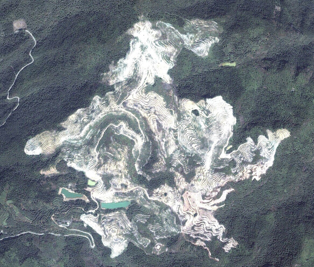
Google Earth
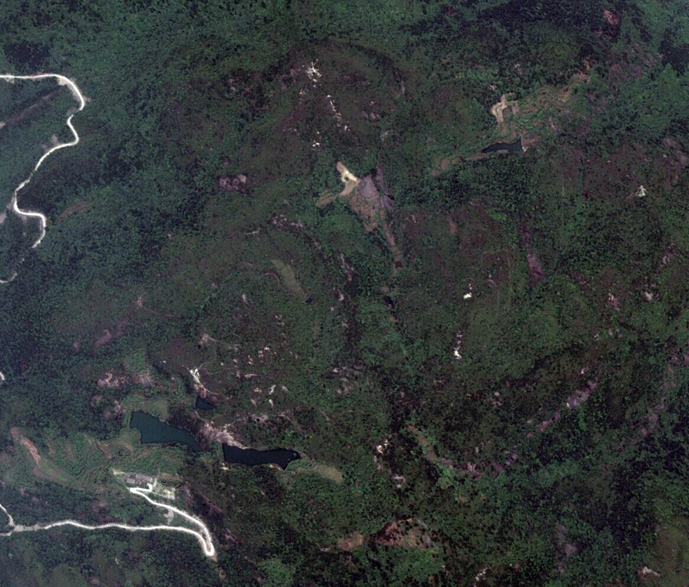
Google Earth
Shimengyu village in Zhejiang province
Why are the forests being cleared so quickly?
As I mentioned above, the forests aren’t being clear-cut in order to construct new real estate, at least not directly. Rather, they’re being cleared for cropland, to compensate for the loss in farmland due to expanding cities. So, except for agricultural infrastructure, we’re not likely to see any construction going on there.
On the whole, deforestation of the kind we’re seeing in Zhejiang is happening faster and on a larger scale now than ever before—over the past few years it’s really been skyrocketing. Fundamentally, this is because both developed areas and rural hinterlands get a big boost in income from the requisition-compensation policy. Near cities, scarce land is valuable for real estate, and local governments in remote areas receive hefty subsidies because of the requisition-compensation quotas, which amount to as much as an entire year’s budget. The only party that loses out is the disappearing forests.
Shennongjia forest region in Hubei province clear cut some mountains and regraded valleys to build an airport. Why did they do that? Did local people protest?
Because Shennongjia is a mountainous area, there wasn’t any level land to build an airport on. It had to be on a mountaintop. That’s why they were blasting open mountainsides and filling in valleys. That’s pretty common in China’s mountainous regions. Generally speaking, if there’s enough flat land to build an airport on, they’re not going to build it on a mountaintop, because it’s so much more expensive. The point of building an airport is to stimulate the local economy, and in Shennongjia that means tourism. Driving on mountain roads, it takes the better part of a day to get into Shennongjia, which means that not many tourists go there.
In my understanding, locals have two stances on the airport construction project. Some people are looking forward to the increase in tourism, which will augment one of their few sources of income. Other people worry that after the airport is built, real estate development will encroach on their land, thereby reducing their income, which will be unfair. Not many local residents are concerned about the ecological damage caused by the construction of the airport.
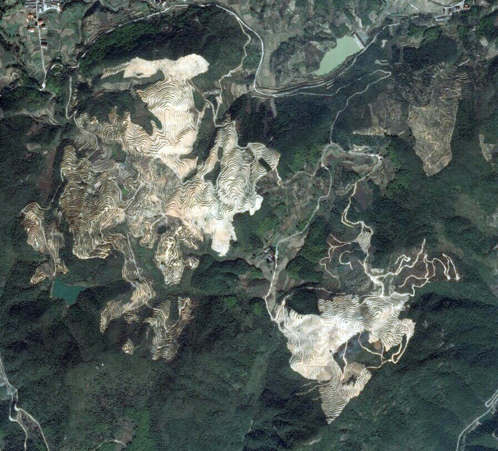
Google Earth
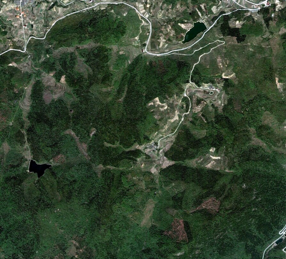
Google Earth
Shimengyu village in Zhejiang province
How do you go about finding the cases you work on andand getting these satellite images? How is the general public reacting to these images so far?
Satellite images are a widespread and well-established means of detecting deforestation problems. Governments, NGOs, and academic researchers the world over use them in their work. Because satellite photos are publically available, and because findings can be repeated and verified, they’re the only way we have of confirming the locations of deforestation episodes and determining the condition of the forests beforehand. Greenpeace has always used satellite photos in its work on forests, and the strategy has proved successful in places like the Amazon, Southeast Asia, and China.
In China, we’re doing surveys of forest areas in Hainan and Yunnan using remote sensing and geographic information systems, and we’re getting good results. We often compare older and more recent satellite images, and use satellites images to verify and complement information gathered by other means. After identifying areas we think are being deforested, we then go onsite to confirm our findings and gather more information.
Now, with platforms like Google Earth, Baidu Maps, Map World (Tiandi Tu) and other web services available both inside and outside of China, it’s possible for ordinary people to recognize potential cases of deforestation using their own eyes. For example, the Zhejiang deforestation incidents are easily visible on Google Earth. Of course, some aspects of the work need to be done by professionals using special software.
What are the most serious deforestation cases you’ve worked on in recent years and is anything changing for the better?
On Hainan Island, we discovered that man-made forests in protected areas were encroaching on the habitat of the 30-plus remaining Hainan black-crested gibbons and preventing their population from growing. In Yunnan province, we found that some of China’s few extant patches of virgin forest were being destroyed by people taking advantage of the “low-yield forest improvement” policy loophole.
But thankfully, both of these situations have now taken a turn for the better. The province of Hainan has designated all of its natural forests as “public welfare forests” and started enlisting specialists to research the problems created by manmade forests in protected areas. Yunnan is investigating and prosecuting people who were cutting down natural forests using the low-yield forest loophole, and in 2013 the province put an end to the practice of clear-cutting virgin forests in order to plant man-made forests. Right now, it looks like the problems have been solved in both of these places. But they’re just a tiny fraction of China’s forests. We’ve got our work cut out for us as we continue to strive for better protection of natural forests in China.
Translated by Austin Woerner.