


China’s New Deserts
![Geologist and environmentalist Yang Yong takes a cigarette break after a long drive. He says, “I’m not doing this for money or fame, I just want to know more. We know so little, and we are now at the point where everyone is concerned about this region and its relationship to climate change. The main discussion is regarding how we can protect, develop, and use it. It’s a massive area, and I can hardly explore every corner of the plateau. And time is running out [for me].”](https://www.chinafile.com/sites/default/files/sanjiangyuan-1-1.jpg) Geologist and environmentalist Yang Yong takes a cigarette break after a long drive. He says, “I’m not doing this for money or fame, I just want to know more. We know so little, and we are now at the point where everyone is concerned about this region and its relationship to climate change. The main discussion is regarding how we can protect, develop, and use it. It’s a massive area, and I can hardly explore every corner of the plateau. And time is running out [for me].”
Geologist and environmentalist Yang Yong takes a cigarette break after a long drive. He says, “I’m not doing this for money or fame, I just want to know more. We know so little, and we are now at the point where everyone is concerned about this region and its relationship to climate change. The main discussion is regarding how we can protect, develop, and use it. It’s a massive area, and I can hardly explore every corner of the plateau. And time is running out [for me].”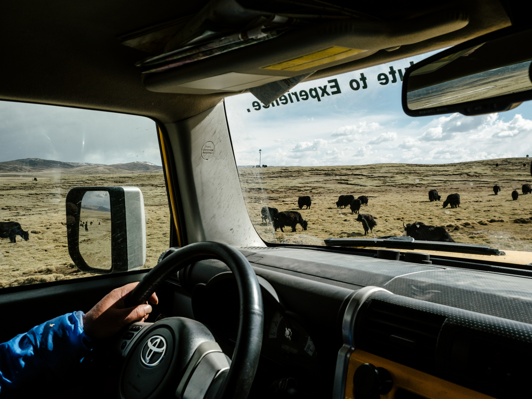 Yang drives past grazing yaks in the Sanjiangyuan National Nature Reserve in Qinghai province. In an effort to address a record dry spell in the Yellow River in the 1990s, as well as other environmental issues, the government established the Sanjiangyuan Reserve to protect the river’s source in northwest Qinghai province.
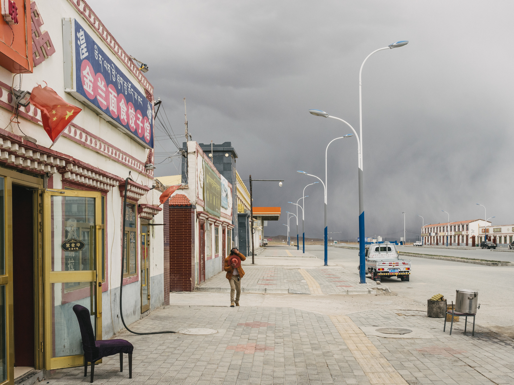 Rain clouds approach Madoi county while Yang’s expedition group eats lunch after stopping to stock up on fuel and food supplies, Golog Tibetan Autonomous Prefecture, Qinghai province. Madoi county has an elevation of around 14,000 feet. Madoi’s annual temperature averages 25 degrees Fahrenheit, and it has very low annual precipitation, averaging less than 13 inches.
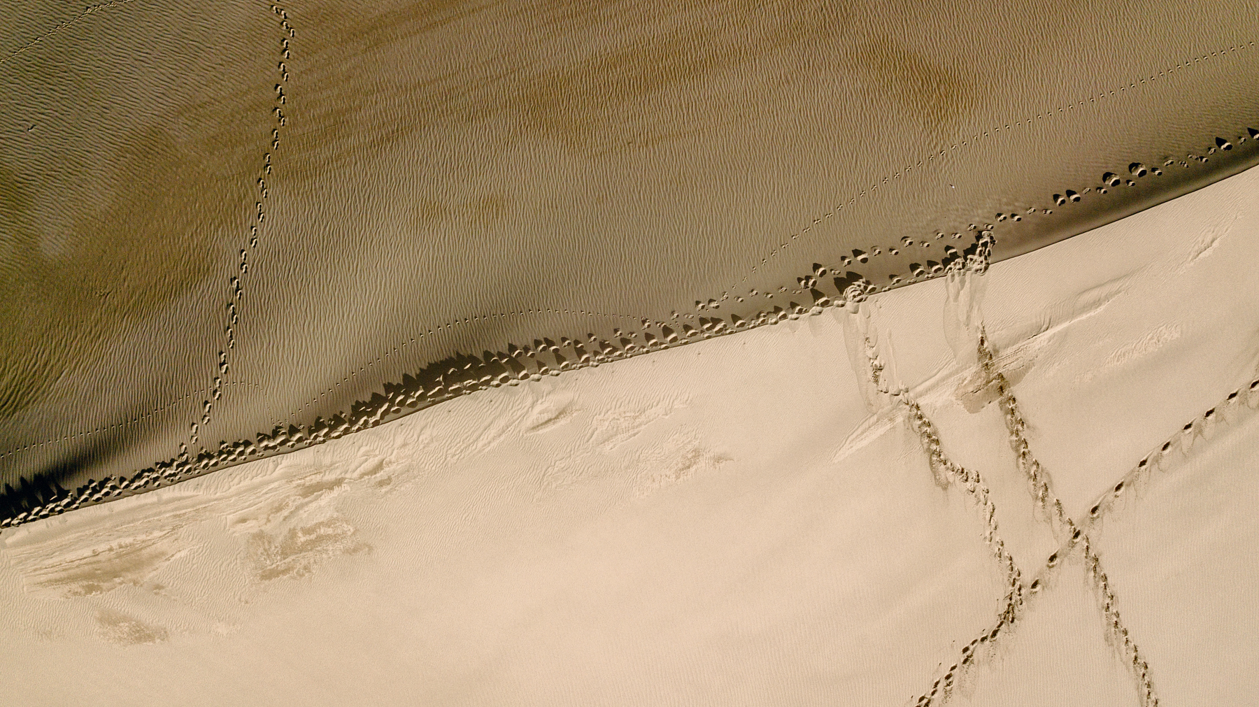
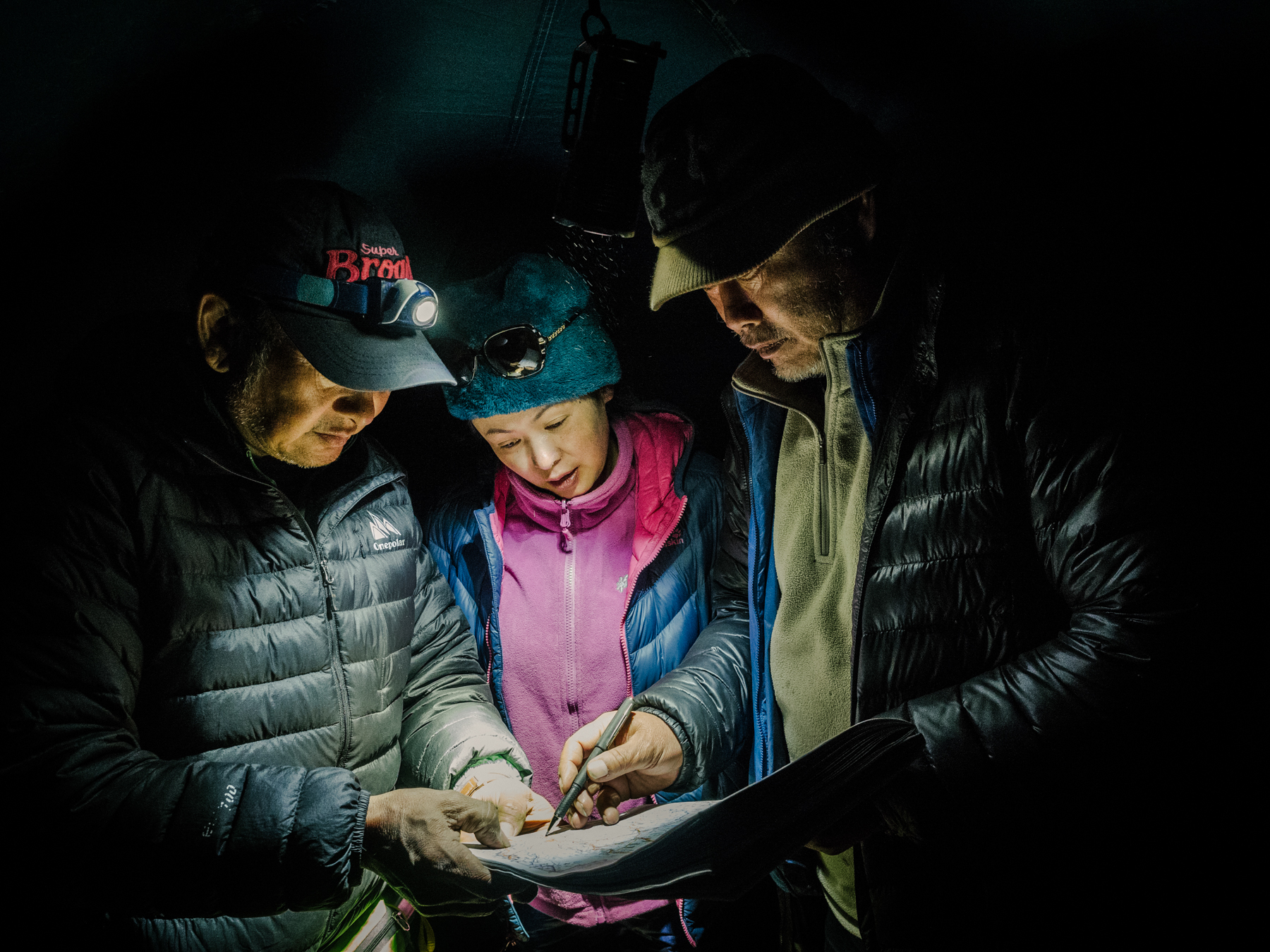
![Yang and a Tibetan herdsman discuss their location on a satellite map, in Madoi county. “Although satellite imaging has documented the advance of these deserts above an altitude of 4,000 meters [13,000 feet],” Yang says, “there are rarely any expeditions to or studies of these newly formed deserts.” As far as he is aware, Yang is the only person who regularly conducts field studies in these areas to assess advancing desertification.](https://www.chinafile.com/sites/default/files/sanjiangyuan-1-9.jpg) Yang and a Tibetan herdsman discuss their location on a satellite map, in Madoi county. “Although satellite imaging has documented the advance of these deserts above an altitude of 4,000 meters [13,000 feet],” Yang says, “there are rarely any expeditions to or studies of these newly formed deserts.” As far as he is aware, Yang is the only person who regularly conducts field studies in these areas to assess advancing desertification.
Yang and a Tibetan herdsman discuss their location on a satellite map, in Madoi county. “Although satellite imaging has documented the advance of these deserts above an altitude of 4,000 meters [13,000 feet],” Yang says, “there are rarely any expeditions to or studies of these newly formed deserts.” As far as he is aware, Yang is the only person who regularly conducts field studies in these areas to assess advancing desertification.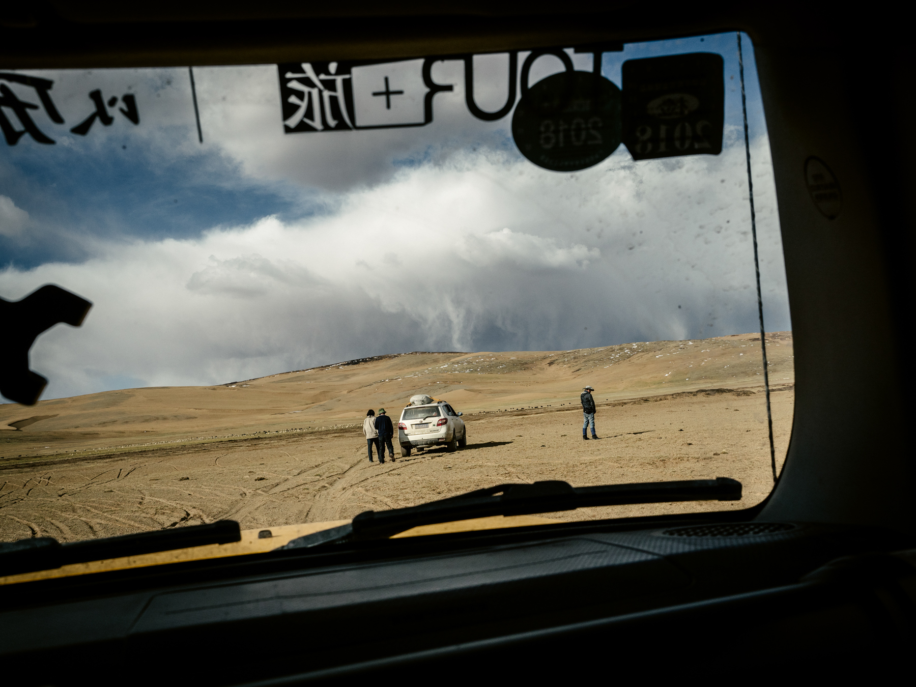
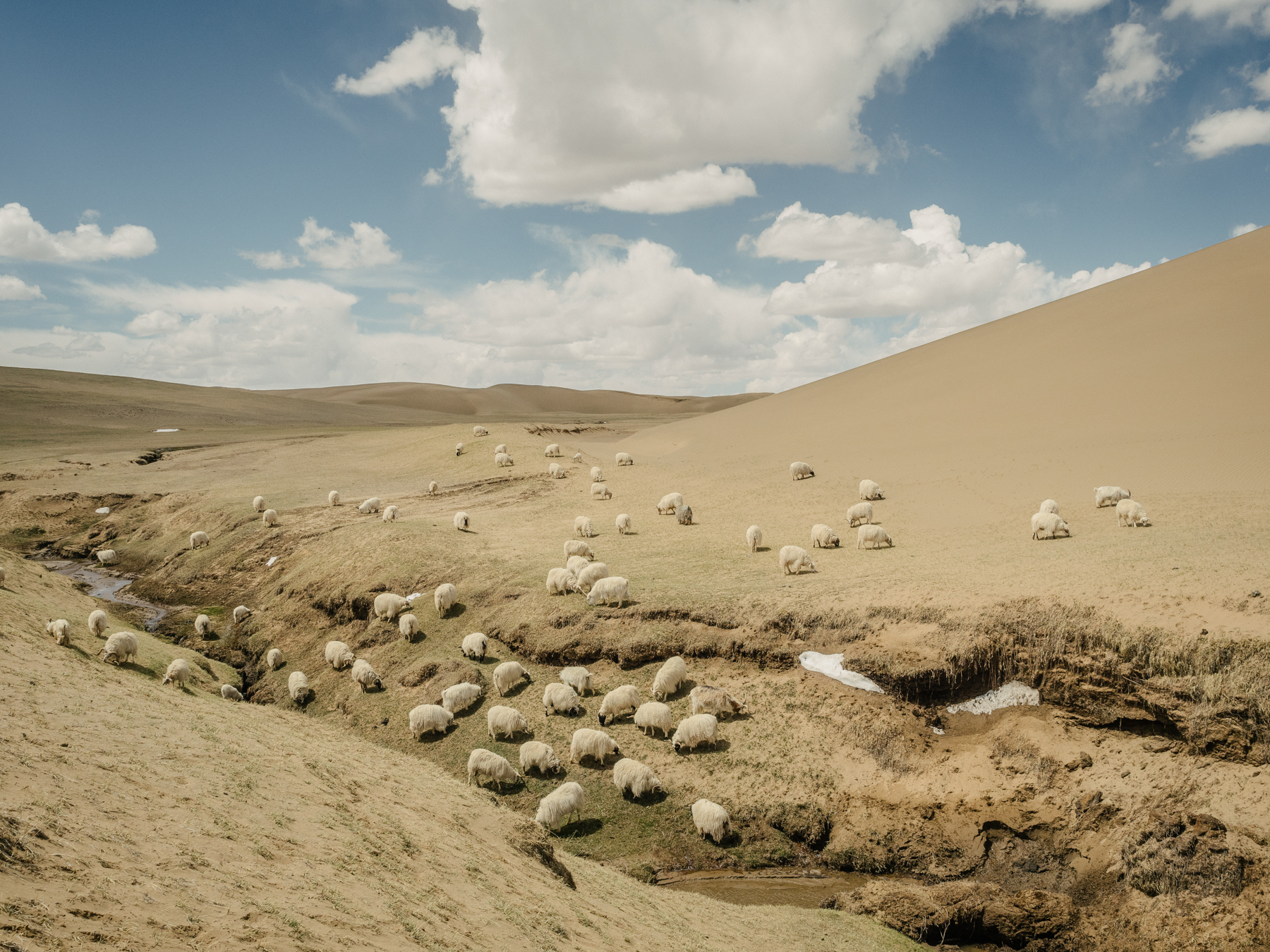
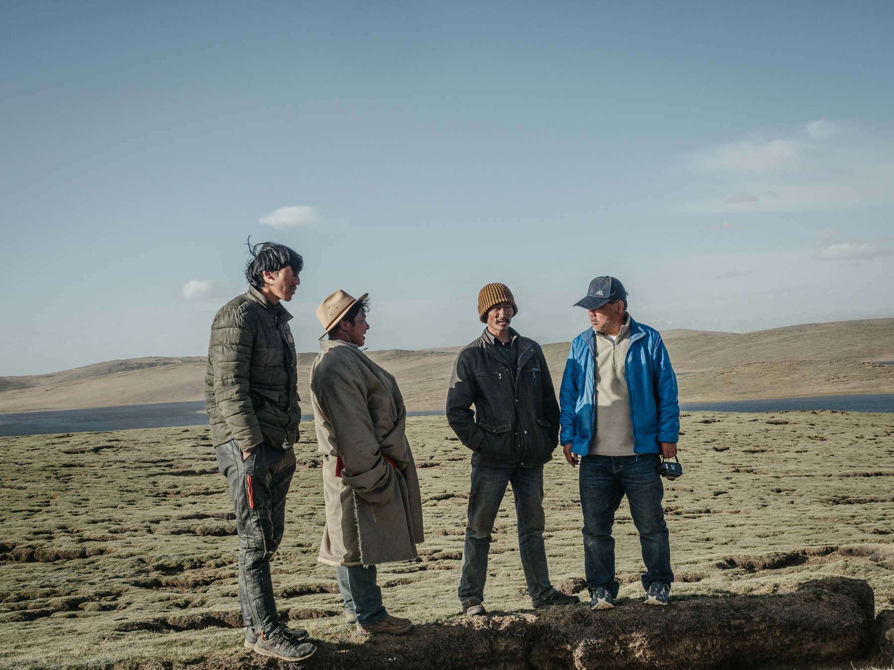 Local Tibetans (left three) greet Yang at the campsite next to the lakes Gangnagemacuo and Rigecuochama. The ground that they stand on shows visible cracks, with sections of the frozen ground having melted and collapsed. This exposes the thin layer of fertile soil to strong winds and burrowing animals, like hares and pikas, causing further degradation and eventual desertification. Yang says that climate change is accelerating desertification of the mountain grasslands.
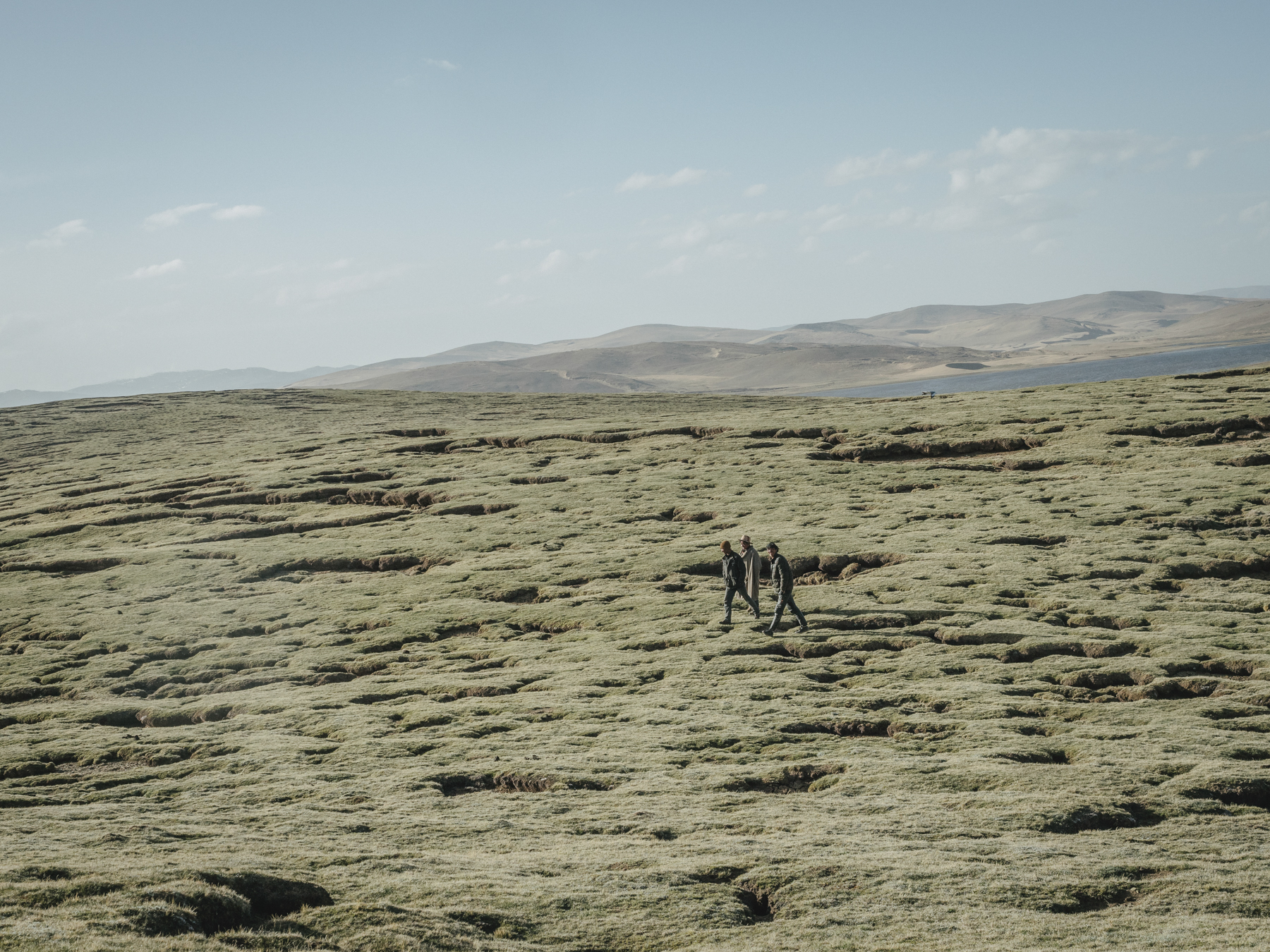
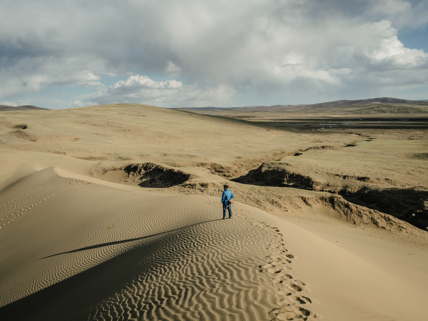
From Madoi county, a settlement near the headwaters of the Yellow River, our two-car convoy headed out to visit a desert Yang Yong had first viewed through binoculars in 1997. From the roadside, the geologist had seen a small, wind-blown patch of sand surrounded by greenery. This time, from the same vantage point, Yang looked out past a stretch of sloping grassland to where a new desert now extended beyond the horizon. That sandy expanse, Yang told me, was where we would sleep that night.
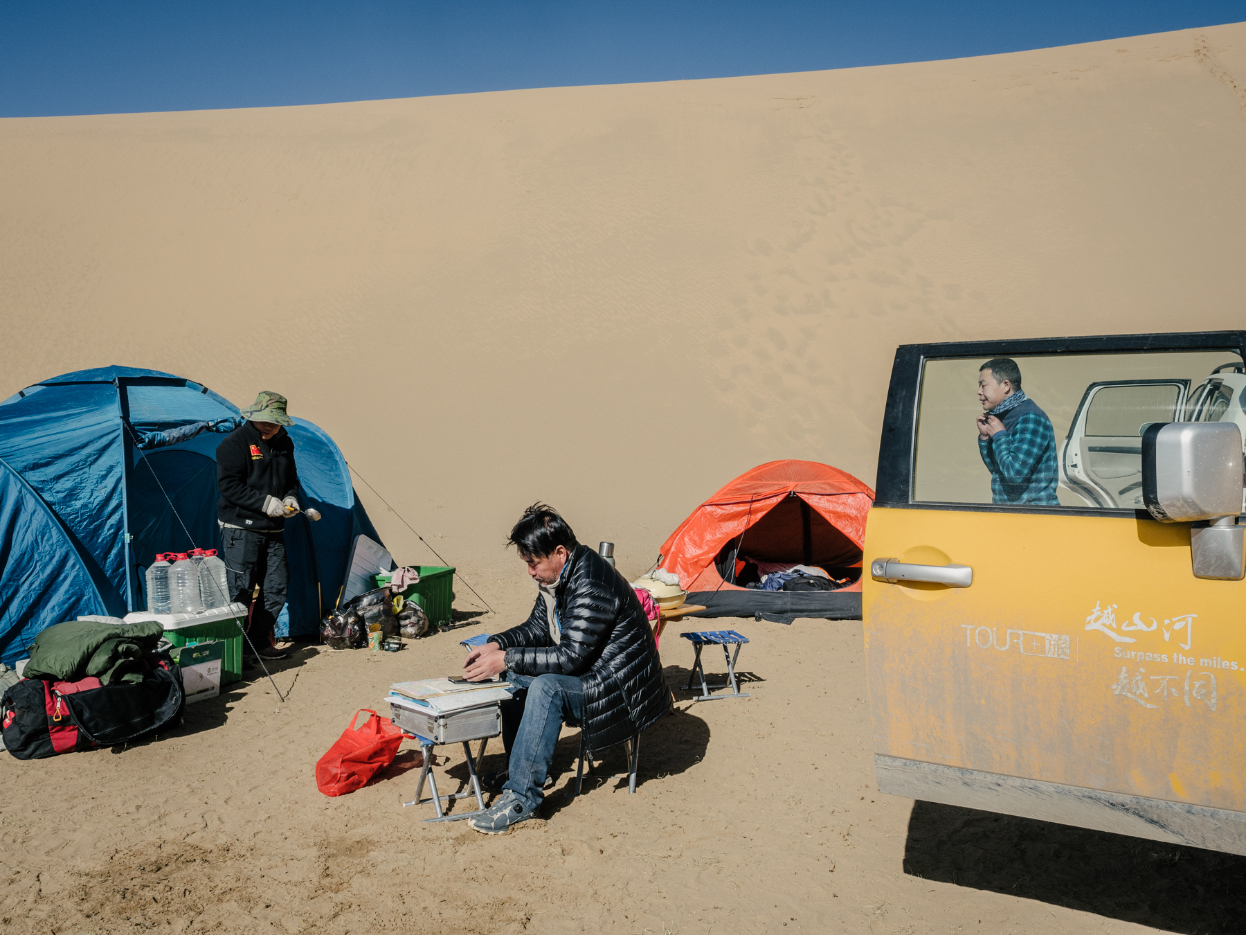
Yang, now 60, is one of China’s most prominent environmentalists. For the past 30 years, he has studied environmental change on the Tibetan Plateau, and in particular the Sanjiangyuan, or “Three River Source,” National Nature Reserve, where the Yellow, Yangtze, and Mekong rivers originate. Using a combination of satellite imaging and other remote sensing, along with data collected on expeditions, he and his crew have documented the degradation of lands at the headwaters of China’s major rivers. In May 2018, I joined Yang on one of his expeditions to document the transformation of the Yellow River and its surrounding landscapes.
Other members of the expedition team, in two sport utility vehicles filled with camping and research equipment, included Yang’s brother, Yang Hongbing, also the expedition chef and co-driver; his childhood friend Lu Yun, who they affectionately call Captain Lu, also the drone operator; Wei Yanwei, his apprentice who assists and records much of Yang’s observations; and his wife, Wang Qian, who handles the budget for the trip.
The Tibetan Plateau spans an area five times the size of Spain, and has an average elevation of 1,4760 feet—slightly higher than the peak of Switzerland’s Matterhorn. After the Antarctic and Arctic, the plateau has the third largest reserve of ice, a fact leading scientists to call it the “Third Pole,” and thus highlighting its relevance to the earth’s climate. As with the other two poles, temperatures on the Tibetan Plateau have been rising much faster than global averages, and many of its 46,000 glaciers are shrinking. The plateau rises high into the earth’s atmosphere, and therefore regulates the weather system throughout Asia. Often referred to as Asia’s “water tower,” the plateau’s lakes, glaciers, and wetlands support about 1.4 billion people downstream.
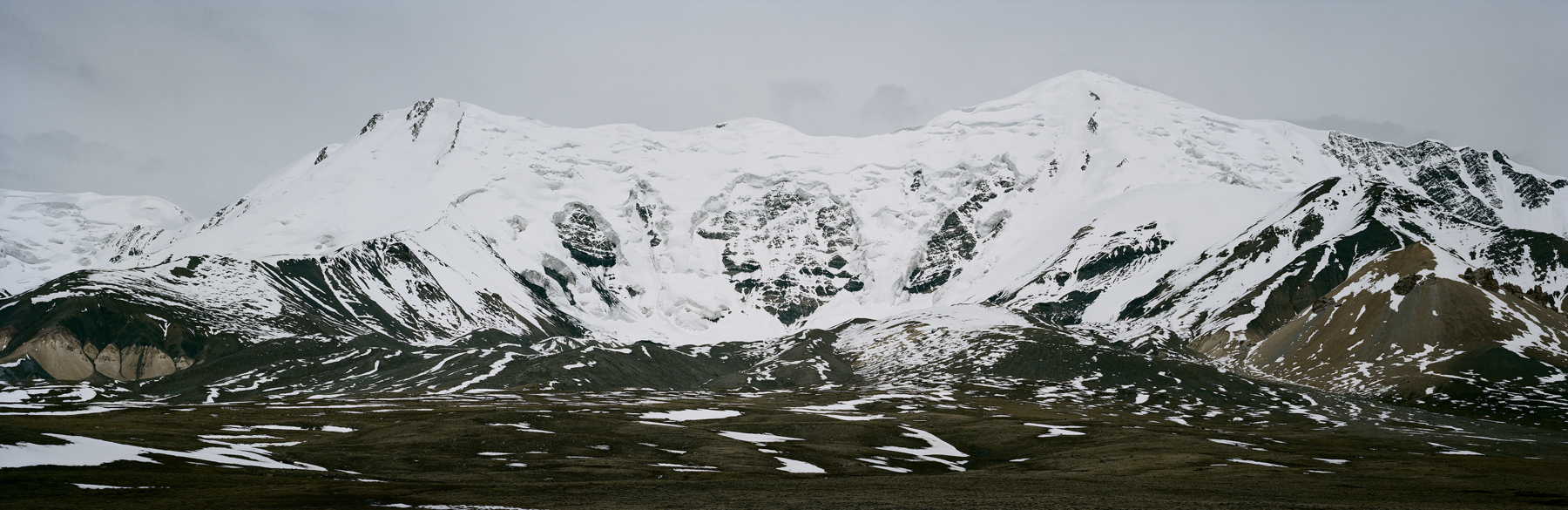
A glacier in the Amne Machin mountains, Qinghai, Tibetan plateau, May 2018.
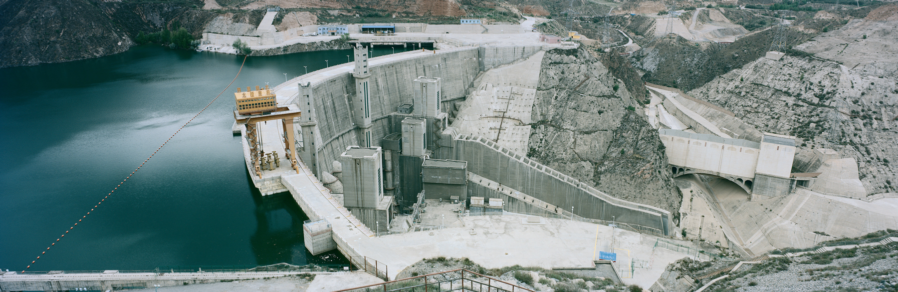
Lijiaxia reservoir and dam, eastern Qinghai province. Construction of the 500-foot-tall dam was finished in 1996, and began generating electricity in 1997. Lijiaxia is one of eight cascade dams built on the Longliu section of the upper region of the Yellow River between 1977 and 2006. Streamflow velocity on this stretch of the river greatly decreased after the construction of the dams, affecting water availability downstream.
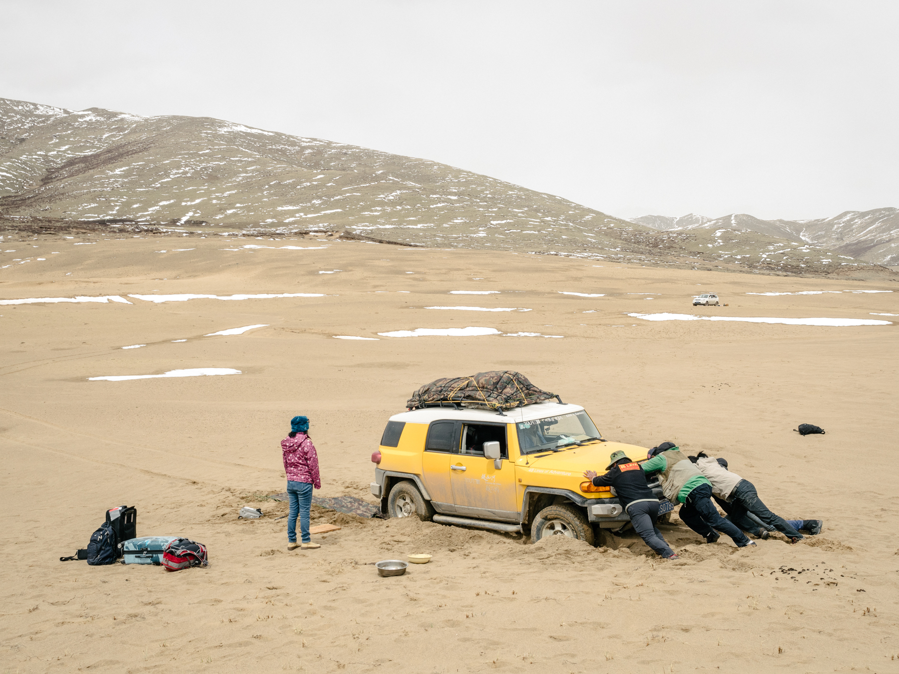
We piled back into our cars and drove off the road with Yang’s yellow SUV leading the way through the grasslands and down the side of a hill. With no obvious route, the uneven ground jolted the car so violently that some of our heads hit the roof. Yang stopped the car and got out. It looked like he had changed his mind about driving any further. He lit a cigarette, taking long drags as he contemplated the challenge ahead.
Shortly afterwards, Yang got back in the car and told us to buckle up. Then, with a series of deft maneuvers, he slalomed the vehicle down the hill so it twisted like an Olympic skier. When we finally did reach the sand, the rest, I thought, should be easy. But our tires spun freely, unable to gain any traction. We were stuck.
There are many forces causing desertification on the plateau, including natural physical processes, human mismanagement, and climate change. The fragile, semi-arid nature of the land is unable to sustain high densities of human and wildlife population, while the cold and dry climate makes it vulnerable to wind erosion. Rising temperatures accelerate the melting of permafrost, exposing once-frozen topsoil to winds and burrowing rodents. Some claim that overgrazing has contributed to the damage, while others believe human activity, like gold mining, bears more responsibility.
Local officials, Yang says, have made progress restricting access to endangered regions, curbing development, and helping nomadic herders find alternative sources of livelihood. He hopes his research will help officials safeguard the Sanjiangyuan Reserve, established in 2000 to protect the headwaters of the Yangtze, Mekong, and Yellow rivers. However, Yang also worries that overprotecting Sanjiangyuan could limit its development potential. “Too much red tape,” he says, “will restrict progress.”